Bullet 80's T's

T-shirts för YouTube-kanal 2kB of Fun
2018


80's T's thumbnail image

Bullet Pixel Art

Pixel art illustration för boken 2kB of Fun
2017


Pixel Art thumbnail image

Bullet 2kB of Fun

Den fantastiska världen av handhållna videospelen från '76-'85
2013


2kB of Fun thumbnail image

Bullet DIY Arkadkabinett

Plattpaket hemmafixare version av Retro Space
2013


DIY Arkadkabinett thumbnail image

Bullet DAF 46 Super Luxe

Renovering hemutvidgning med ny carport för DAF 46
2012


DAF 46 Super Luxe thumbnail image

Bullet STRP Festival 2011

Foto rapport från STRP Festival 2011 av Mick Visser
2011


STRP Festival 2011 thumbnail image

Bullet Katakana Converter

Verktyg för att konvertera Rōmaji, Katakana och ASCII/UTF-8
2011


Katakana Converter thumbnail image

Bullet STRP Festival 2010

Foto rapport från STRP Festival 2010 av Mick Visser
2010


STRP Festival 2010 thumbnail image

Bullet Brittisk Hyresvärd

Lyxvillor vid Berlaer platsen i Helmond
2010


Brittisk Hyresvärd thumbnail image

Bullet M+ M- ???

Redesign av den klassiska skrivbord kalkylator inom 1 timme
2010


M+ M- ??? thumbnail image

Bullet Kreativfabrik

Interiör fotografier av kreativa företagen i historiska Philips fabrik
2010


Kreativfabrik thumbnail image

Bullet Future Space

26 arkadkabinetter för Dutch Game Garden
2010


Future Space thumbnail image

Bullet Lost in Navigation

Denna text är inte översatt till svenska och endast tillgänglig på engelska.

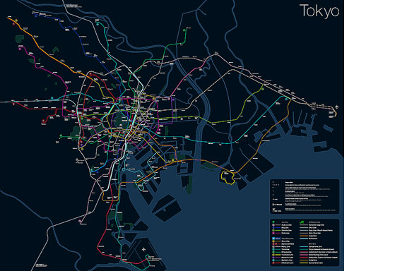
Tokyo is a breathtaking city. Most metropolises have 1 urban railway network. Easy. Tokyo, the biggest metropolis on Earth, is a lot more complex.
The city has 2 official subway companies, the national railway operates several lines that can be considered metro lines as well, and there are tens of private operated railways that serve may areas just outside the central part of the city. Another problem is that many transfer stations use different station names on each line connected.

Creating a understandable subway map for this city is extremely complex. Should it be schematic, or geographic realistic? When is it easier to have a short walk than to switch lines?

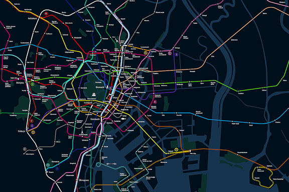
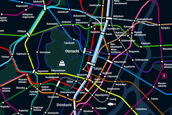
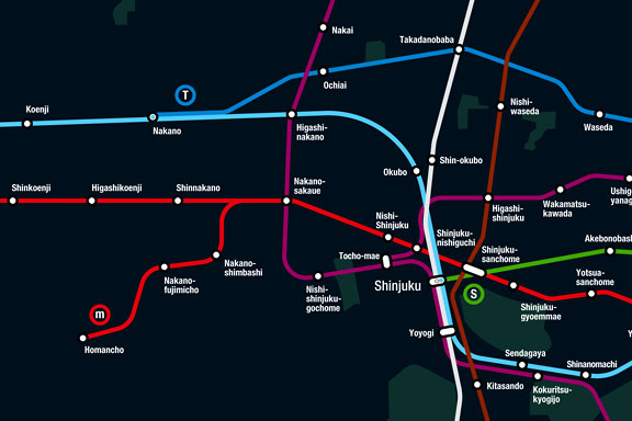
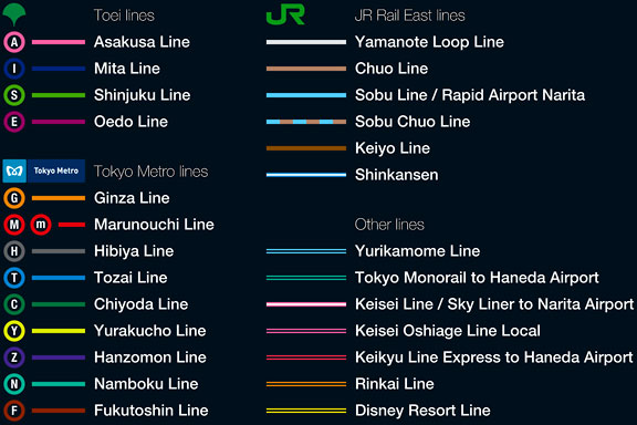
This metro map for Tokyo only shows the most important lines for visitors of the city. That is already 25 lines! All distances are realistic, and the connections to Airports and Shinkansen trains are clearly visible. The parks that give a good orientation in the grey urban mass of Tokyo are visible. Icons show the most important landmarks. Matching the million neon lights the map is drawn in a night situation with the lines as glowing neon tubes.

The map is printed on 100x75 cm photo paper in a limited run, an can be ordered. Send an e-mail or call if you are interested to order.


Bullet XXL

En ny fabrik för Kingspan isoleringspaneler vid Medel nära Tiel
2009


XXL thumbnail image